Utting am Ammersee
Appearance move to sidebar hideYou can help expand this article with text translated from the corresponding article in German. (November 2022) Click for important translation instructions.
|
| Utting am Ammersee | |
|---|---|
| Municipality | |
 Town hall Town hall | |
 Coat of arms Coat of arms | |
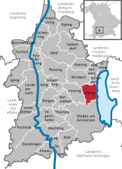
Location of Utting am Ammersee within Landsberg am Lech district
 | |
  | |
| Coordinates: 48°2′N 11°5′E / 48.033°N 11.083°E / 48.033; 11.083 | |
| Country | Germany |
| State | Bavaria |
| Admin. region | Oberbayern |
| District | Landsberg am Lech |
| Government | |
| • Mayor (2020–26) | Florian Hoffmann |
| Area | |
| • Total | 19.03 km2 (7.35 sq mi) |
| Elevation | 554 m (1,818 ft) |
| Population (2022-12-31) | |
| • Total | 4,564 |
| • Density | 240/km2 (620/sq mi) |
| Time zone | UTC+01:00 (CET) |
| • Summer (DST) | UTC+02:00 (CEST) |
| Postal codes | 86919 |
| Dialling codes | 08806 |
| Vehicle registration | LL |
| Website | www.utting.de |
Utting am Ammersee (until 1953 just Utting) is a municipality in the district of Landsberg in Bavaria in Germany.
History
During World War II, a subcamp of Dachau concentration camp was located in the town.
Transport
 Ammersee-Dampfbahn Utting 16.jpg
The municipality has a railway station, Utting, on the Mering–Weilheim line.
References
- ^ Liste der ersten Bürgermeister/Oberbürgermeister in kreisangehörigen Gemeinden, Bayerisches Landesamt für Statistik, 15 July 2021.
- ^ Genesis Online-Datenbank des Bayerischen Landesamtes für Statistik Tabelle 12411-003r Fortschreibung des Bevölkerungsstandes: Gemeinden, Stichtag (Einwohnerzahlen auf Grundlage des Zensus 2011).
- ^ "Archived copy". www.glosk.com. Archived from the original on 25 August 2019. Retrieved 6 June 2022.{{cite web}}: CS1 maint: archived copy as title (link)
External links
- European Holocaust Memorial - a monument ensemble against racism and totalitarianism at the place of the crime - under the executive management of the Citizens´ Association European Holocaust Memorial Foundation
- The Holocaust in the Landsberg area- Citizens´ Association "Landsberg in the 20th Century" (English)
| Towns and municipalities in Landsberg (district) | ||
|---|---|---|
| ||
| International | |
|---|---|
| National | |
| Geographic | |
This Landsberg district location article is a stub. You can help Wikipedia by expanding it. |